Kew Bridge development
19th century
|
|
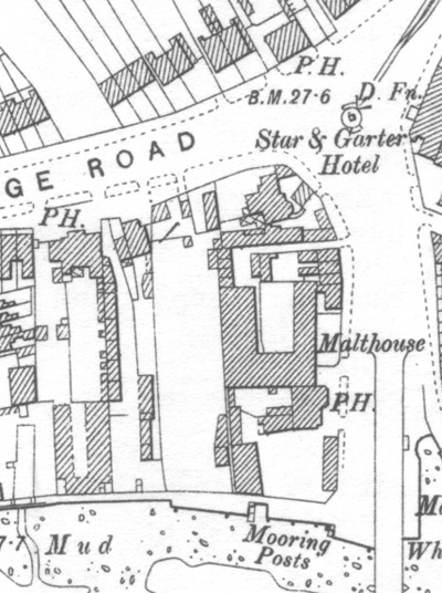
The site changed immensely during the 19th century. By 1894 the Ordnance Survey map shows many buildings there. This section is divided into three partsThomas Layton who lived in the house on the corner of Kew Road and Kew Bridge road and the market outside his front door. The Public Houses - three of which are shown though there were in fact five. The malthouse and the boathouse Apart from these uses, the 1894 street directory identifies private residents as well as a confectioner, a coffee shop and a dress maker on the site. The bridge shown heading out of the map at the bottom right is the second Kew Bridge built in 1789, slightly to the east of the first bridge. It was replaced by the present wider bridge in 1903. |
 From 1825
the fine 18th century house on the corner of Kew Road - which crosses the
bridge - and Kew Bridge Road - which is parallel to the river - was occupied
by the Layton family. Part of it is visible in the picture above on the
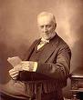
right. Thomas Layton, the son, was just 6 when he moved there and he died in
the house aged 92 in 1911. He was a Brentford councillor for
50 years and a successful local businessman. He was an avid collector and
many of the smaller buildings near the house were used by him to store his
collection. You can find out more about Thomas Layton at the website of the
Thomas Layton
Collection. From 1825
the fine 18th century house on the corner of Kew Road - which crosses the
bridge - and Kew Bridge Road - which is parallel to the river - was occupied
by the Layton family. Part of it is visible in the picture above on the
right. Thomas Layton, the son, was just 6 when he moved there and he died in
the house aged 92 in 1911. He was a Brentford councillor for
50 years and a successful local businessman. He was an avid collector and
many of the smaller buildings near the house were used by him to store his
collection. You can find out more about Thomas Layton at the website of the
Thomas Layton
Collection.
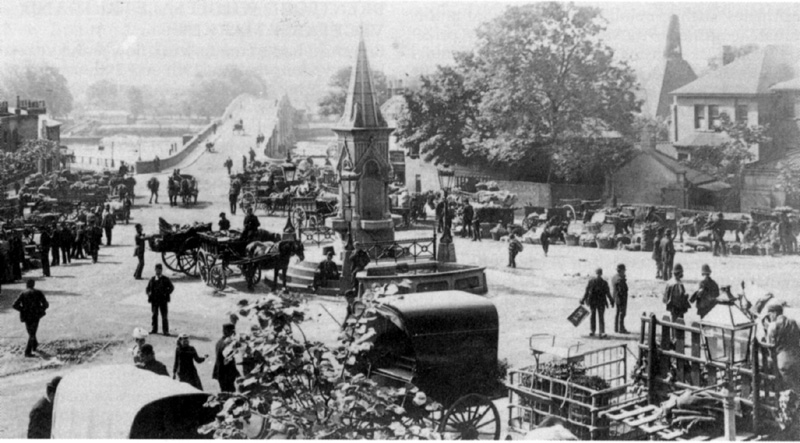
This image also shows the drinking fountain installed in 1877 and the informal market which occupied this junction from 1888. The market was moved to land on the opposite side of Kew Bridge Road in 1893. The market moved into a building in 1906 expanded again in 1921. In 1974 it transferred to Southall and the fountain went with it. It is still on that land which is owned by Western International Market. |
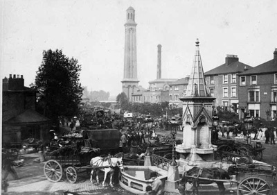 Another view of the fountain showing the horse troughs taken in 1892 looking west along Kew Bridge Road. |
|
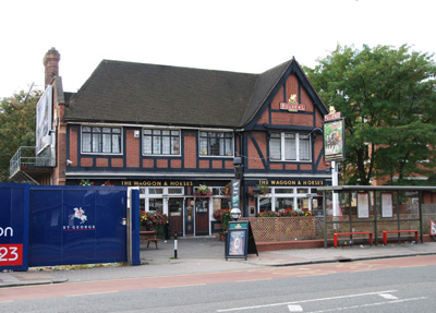
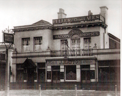
There are three public houses marked PH on the map. The PH nearest to the river was opened in 1839 as Poplar Inn but changed its name in 1867 to the Oxford and Cambridge Hotel. It was owned by the Royal Brewery and bottle tops and bottles with those markings were found when the site was excavated in 2007. The PH on Kew Bridge Road is the Waggon & Horses, a major coaching inn when the road was the main route to the west out of London, first recorded in 1759. In 1840 it was rebuilt larger and slightly back from the road. That building was demolished and rebuilt in 1937/38. It is now due for demolition once more. Next to the Waggon & Horses towards the bridge is The Plough, a beer house first recorded in 1853. It was damaged on 16 November 1940 by German bombing, extended after the war and finally demolished in 2000. Its pub sign is still on the site. The PH on the other side of Kew Bridge Road is the Express Tavern which was open by the 1860s and is still in use as a pub today. Opposite that is the Star & Garter Hotel, another 18th century coaching inn converted to offices and partly rebuilt in 1984. When the second Kew Bridge was opened on 22 September 1789 a celebration dinner was held at the Star & Garter. The hotel stabled visiting horses on the Kew Bridge site behind Layton's house. That narrow alley became known as Star Yard and small houses were built there towards the end of the century.
|
 |
 |
|
|
The Waggon & Horses in 2007 |
A 1921 image of the 1840 rebuild of The Waggon & Horses |
 |
|
|
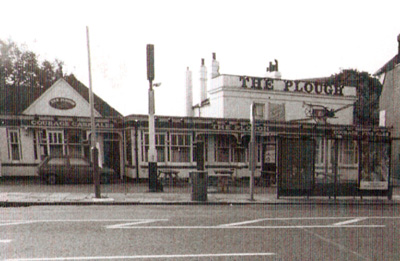
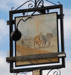
The Plough in 1992. |
The Plough sign in 2007. |
|
The large U-shaped building shown on the 1894 map above is Jupp's malthouse. There were many malthouses in the area including two down Strand on the Green. They malted barely for use in local beer, particularly the Fuller brewery down the river. The process of malting allows grain to germinate and then heats it to prevent further development. The malted grain has enzymes and sugars which are used in making beer. A malt-house is a single storey building which needs a sloping floor and of course access to grain and coal. The river provides all three. Jupp's wharf is see above the mooring posts where coal and grain were landed at high tide. The building to the right is a boathouse. There was a boathouse on the site until it was cleared in 1992.
|
| Jupp's malthouse can be seen to the right of this image. The tall cowled chimney is typical. William Jupp had owned the malthouse from at least 1877 and it is found on an 1865 map as well. Jupp & Sons were also coal and corn merchants. So they had malting sewn up. | 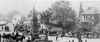 |
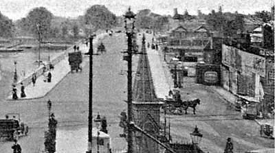 |
The large gabled building at the end of the path by the bridge is the boathouse, built between 1865 and 1881. It was to survive every other building on the site except the Plough Inn. Compare the width of the 1903 bridge here with the 1789 bridge in the image above. |
I am grateful to Debbie Radcliffe who has done brilliant and detailed research into the history of the site and who has kindly given me access to her work.